Shelburne County Trans Canada Rail trail Preview

Access this tour for free

Experience this tour for free. Available through our app.

Download or access the app

iOS Android Web
1

Trailhead in Charlesville at connection of Yarmouth County and Shelburne County rail trails

Trailhead in Lower East Pubnico / Charlesville at connection of Yarmouth County and Shelburne County rail trails. This is the western end of the shared multiuse Shelburne County Rail Trail at the Shelburne County and Yarmouth County line on Highway 3 in Charlesville It is part of the Western Loop of the Trans Canada Trail connecting communities, counties and the country in Nova Scotia. Volunteers from the Woodland Multiuse Trail Association and the Shelburne County ATV Association have built and maintain the trails along with the users, volunteers and community members along the trail. This trailhead is at CNR Mile 101.1 of the Halifax and South Western Railway from Liverpool to Yarmouth. The Yarmouth ferry terminal is at CNR Mile 136.7 via the Yarmouth County Trails Association Trail.

2

Pope's Road Trailhead

A wonderful spacious rendez -vous point for trail users and travelers at CNR mile 99.6 on the Halifax and South Western Railway from Liverpool to Yarmouth. It is 2.3 kilometers south of the trailhead at the Yarmouth County line connecting to Yarmouth County Trails Association Trail into the Town of Yarmouth and 6.3 kilometers from Cemetery road in Lower Woods Harbour. There is also access 1.3 kilometers north from Highway 3 in Upper Woods Harbour to a parking area near the Hardings Brook dam and bridge. A good ride through Acadian coastal forest, marshlands and wetlands - Stay On the Trail!!!

3

Sharing the trail

Enjoy the neighbors who use the trail as they "go round the village". The Shelburne County Rail Trail is a shared multiuse trail for all users including walkers, hikers, runners, bicycle riders, horse riders and OHV riders. It is a level, packed gravel surface maintained by trail users and members of the Woodland Multiuse Trail Association and Shelburne County ATV Association.

4

Wagon Ride on the Cockawit trail

A walk or ride along the trail is a wonderful way to experience the outdoors and time with friends. Plan your own adventure for whatever distance or time you wish. The trail is used for your daily outdoor exercise, meeting with friends, municipal recreation activities and even charity events. The Shelburne County Rail Trail is part of the Western Loop of the Trans Canada Trail around western Nova Scotia. It is easily accessible for all capabilities of outdoor users. Travel on level well packed gravel trails recovered from the abandoned Halifax and South Western Railway.

5

Riders on the trail to Woods Harbour

There are a variety of trail users on the 12 kilometers of shared multiuse trail between Woods Harbour and Barrington Passage. Let's ride to town and back home...

6

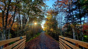
Cockawit trail at Shag Harbour trail bridge.

Cockawit trail at Shag Harbour trail bridge: The Indian name Cockeuquit, which referred to a species of duck, still survives as "Cockawit". People from the Woods Harbour and Shag Harbour area are locally known as "Cockawitters" (or with local slang applying; "Cockawittas"). Cockerwit Passage is a body of water that leads to the mouth of Woods Harbour from the west. This section of trail is whatever length you wish to make of it. The Shag Harbour Bridge is one kilometer east of the access at Shag Harbour Station Road (near civic 5539 Hwy 3). The bridge is at CNR Mile 91.7 along the abandoned Halifax and South Western Railway which is being recovered as shared multiuse trail by the Woodland Multiuse Trail Association with support from the Shelburne County ATV Association. The Cockawit T'Railway goes west from here for 3.9 kilometers through marshland, wetland and coastal forest to the Lower Woods Harbour Station Road (near the Woods Harbour Post Office and civic 6539 Hwy 3). Enjoy the neighbors who use the 1.7 kilometer trail as they "go round the village" of Woods Harbour from Station Road to Cemetery Road on the short shared multiuse Woods Harbour trail. Users keep the trail maintained and litter free.

7

Lupins on trail near Doctor’s Cove cemetery.

Lupins on trail near Doctor’s Cove cemetery: Lupins on the trail in season near Doctor's Cove Cemetery at CNR Mile point 88.1 from Liverpool on the abandoned Halifax and South Western Railway . Trail users keep it clean and litter free using waste disposal bins at cemetery entrance. .Enter off Highway 3 in Doctors Cove going 100 yards north on Cemetery road or 300 meters west along the trail from civic 3920 Hwy 3 in Doctors Cove.

8

Doctors Cove trail bridge

Doctors Cove trail west of Barrington at Fresh Brook. CN Mile Point 87.8 Doctor's Cove Trail bridge at Fresh Brook and CNR Mile point 87.8 between Liverpool and Yarmouth on the abandoned Halifax and South Western Railway. Beautiful views and memorial trail bench only a short one kilometer walk or ride west from the Sgt Taylor Memorial Park and Trailhead. All built and refurbished by volunteers from the community organized by the Woodland Multiuse Trail Association and the Shelburne County All Terrain Vehicle Association.

9

Multi-use trail near Doctors Cove

Horse rider near Fresh Brook at Doctor's Cove and CNR Mile 87.6 from Liverpool to Yarmouth.Expect multiple users and respect among users as they share this long distance connected multi use trail as you start your travel towards Yarmouth County. Access to this section of trail is from the Trailhead at Sgt Taylor Memorial Park at CNR Mile 87.3 which is where the Cape Sale Island Causeway Highway 330 and the trail cross.

10

Sgt Taylor Memorial Park and Trailhead

Sgt Taylor Memorial Park and Trailhead: The trail meeting point for the Shelburne County Trans Canada Rail Trail with all services. At Mile 87.3 of the Halifax and South Western T'Railway between Liverpool and Yarmouth and civic 34 Highway 330 at the Causeway in Barrington Passage. Go on the Western Loop of the Trans Canada Trail around Nova Scotia via Yarmouth. This is the gateway to South West Nova Scotia.

11

Barrington Bay Trail

Barrington Bay Trail: A pleasant 1.3 kilometer transit between the Causeway Trailhead at Highway 330 and The Starboard Inn at 3413 Highway 3 to meet the community and admire its bay side setting. This is a very easy trail with crushed gravel surface with accessibility for all users. This is a heavily used section of trail by a wide variety of users. Users keep it clean and maintained.

12

At Downeys river bridge

At Downeys River bridge: On the Clement's Pond to Barrington Bay T'Railway section of the Western Loop of the TransCanada Trail across Shelburne County. It is an easy transit 500 yards west from near civic 2731 Highway 3 in Barrington or 1.2 kilometer easy hike or ride from Wireless Road where the trail crosses the road. A nice pleasant neighborly walk during which you may see horses, OHV riders, dog walkers or bicyclists. Enjoy each other outdoors.

13

Barrington River (Kiack Brook) bridge at Barrington Head.

Barrington River (Kiack Brook) bridge at Barrington Head: This spectacular bridge was the replacement in 2015 for the unserviceable rail bridge to maintain the trail connections across the community, county and country. It is at Mile 83.0 from Liverpool to Yarmouth of the abandoned Halifax and South Western Railway. It is easily accessible for all trail users near the Barrington Post Office and Cape Sable Historical Society and Barrington Visitor Information Center. A beautiful picnic spot with memorial benches.

14

Clement’s Pond treasured wetland trail

Clement’s Pond treasured wetland trail: Swaines Bog was designated as "Rare Beauty" in 2018 as a Treasured Wetland of Nova Scotia with Ducks Unlimited Canada for its rare flora. You can add to the photo history of the view from the photo post mounted beside the trail. It is located about one kilometer east of the trail crossing at Kilometer 63 of Highway 103. A better access point is from the east end of the Clyde River / Clement's Pond T'Railway at Lyles road and Highway 309 in Port Clyde. The parking area is 1.2 kilometers west on Lyles Road to the trailhead. The photo post is 3.5 kilometer transit from this point through an easy level packed gravel trail and woods and wetlands with memorial rest benches along the way.

15

Swaines Bog Treasured wetland rare beauty

Rare Beauty, Community Sweetheart, Migration Hot Spot and Sound of Silence are the nicknames given to the four wetlands in Nova Scotia that are being pegged as Treasured Wetlands under a new program being officially launched by Ducks Unlimited Canada in partnership with the provincial Department of Natural Resources.The Swaine’s Road Bog in Shelburne County, home to the rare thread-leaved sundew plant, the Annapolis Royal Marsh, the Cole Harbour Salt Water Marsh and the Black River Bog in Cape Breton are the wetlands identified for the Treasured Wetlands of Nova Scotia program. “The idea is to encourage and inspire Nova Scotians to get outside and explore these wetlands,” said Chelsea Murray, communication specialist for Ducks Unlimited Canada in Atlantic Region, in an interview.Besides an interpretive sign, the posts are “made so you can put a phone on a bracket, so everyone can put their phone in the same spot so as people are visiting, they take the same picture over and over again and share it on social media and that way we can track what the wetland looks like over time,” said Murray.

16

Black Loyalist Heritage Trail

Stroll or hike along the Black Loyalist Heritage Trail, a 1.5 km heritage trail around the Black Burial Ground with interpretive panels. It is currently a non motorized trail recovered from and beside the abandoned Halifax and South Western RailwayThe Black Loyalist Heritage Site, located in Birchtown in the South Shore region (approximately 7 km northwest of Shelburne) commemorates the history and contributions of the Black Loyalists who were some of Canada’s first settlers. Birchtown had the distinction of being the largest free Black community in British North America in the late 18th century. It was the centre of the Black Loyalist experience and its founding represented a turning point in the history of persons of African descent in Canada. There is much to explore on this heritage site including the National Historic Monument of Canada honoring the landing of the Black Loyalists in Canada; St. Paul’s Church (circa 1888); and the Old School House Museum, a one-room school house built in the 1830s which exhibits various artifacts from the archaeological digs and other items which have been donated and loaned to the museum. Site amenities include a gift shop, public washrooms, parking and picnic area.

17

Roseway River trail

Roseway River Trail (Approx. 1KM) Shelburne, NS The Roseway River Trail crosses the Roseway River near Falls Lane on two small CN bridges that have a fenced board walk along them.Breathe the fresh air and take in the abundant nature. Bring good walking shoes for muddy trails on wet days.

18

Shelburne Rail Trail

The Town has developed a 3.5 km section of the abandoned rail line in Town as a trail.The trail is maintained for active transportation and recreational use. Motorized vehicles are prohibited on the trail. Dogs must be kept on leash at all times. This section of trail links with a section managed by the Municipality of Shelburne that runs from the Roseway River to the Islands Provincial ParkDESCRIPTIONAs has happened with many of the decommissioned rail lines, the local community converted the rail bed through town into a wide, easy trail that invites all means of human powered transportation. The route runs from King Street to the Falls Lane Bridge on the Roseway River.ACCESSAccessed within Shelburne off King St, inbetween Parr St and Cornwallis St.MORE INFOWith the ultimate goal to be part of the Trans Canada Trail, almost half of the 93 km of abandoned rail line in Shelburne County has been developed into a multi-use trail.

19

Jordan Branch T'Railway

View of Lockies Wetland north of Lockies trail bridge at Mile 48.6.This is a shared multi use trail for all users including hikers, walkers, bicyclists, horse riders, OHV riders in all seasons. This is a easy trail and accessible to all.This section of the trail is 6.3 km long.Access to Lockies wetland views and Lockies Brook Bridge is from the parking lot and trailhead at 1511 Jordan Branch Road. This is an easy trail on level packed gravel and accessible to all non highway users. Enjoy meeting the local neighbors who frequently walk the trail and see if you can spot the gnomes decorating the trail (not the trail cameras).

20

Purney Brook bridge on Jordan Branch T’Railway

Purney Brook bridge on Jordan Branch T’Railway (3.3 km east from trailhead at1511 Jordan Branch Road).This is part of the 6.3km long Jordan Branch Trail.This bridge crosses a spectacular brook (with fishing in season) and wonderful photo location especially in the fall season. It is at CNR Mile 47.1 on the Halifax and South Western Railway from Liverpool to Yarmouth. There is also access from the trail / driveway crossing at 726 Jordan Branch Road by going west for a one kilometer ride. Note the memorial marker on this trail. RIP.

21

Jordan Branch T'railway as part of Trans Canada Trail

Trans Canada Trail includes Shelburne County Rail Trail and Jordan Branch Trailway. This is a shared multi use trail for all users including hikers, walkers, bicyclists, horse riders, OHV riders in all seasons. This is a easy trail and accessible to all.

22

The Jordan River Trail

This is currently a non mortorized trail.The Jordan River Trail is located along the abandoned Halifax and Southwestern railway line. The railway carried passengers and freight between Halifax and Yarmouth from 1907-1969. The trail winds through a salt marsh, home to ducks, herons, and other birds. It crosses the Jordan River and ends at the Jordan Branch Road. On a clear day there is a fantastic view from the bridge looking both up the river and out to the ocean. Trees and other plants to look for along the way include speckled alder, wild rose, mountain ash, red maple, birch, tamarack, white pine, and the occasional locust.The trail head is located at 146 Hayden's Road, a short dirt road loop off Hwy 3 heading towards Lockeport from exit 24 off Hwy 103 at Jordan Falls. A return trip on the trail is just over 5kms on a flat gravelled surface. A leisurely stroll stopping to enjoy the scenery may take about 1.5 hours. The Shelburne County Arts Council has installed a sturdy wind chime of scrap metal by local artist and former blacksmith, Hayward Meisner near the bridge. It has a lovely tone and stands on a tri-pod with a decorative treble cleft on the top.

23

Ogden Creek on Camp Jordan portion of East Jordan Trail

This is a shared multi use trail for all users including hikers, walkers, bicyclists, horse riders, OHV riders in all seasons. This is a easy trail and accessible to all.This bridge is on a 2km section beside Jordan River between Camp Jordan and Ogden Creek beside Highway 3 at East Jordan.Please respect all users.This is a beautiful rendez-vous point across the road from 5626 East Jordan Road dry hydrant. Please don't block emergency vehicle use of the dry hydrant. It is at Mile 42.9 of the Halifax and South Western Railway. Stay on the trail and say hello to the neighbors who live close by the trail. Enjoy the views.

24

East River and Bridge

This is a shared multi use trail for all users including hikers, walkers, bicyclists, horse riders, OHV riders in all seasons. This is a easy trail and accessible to all.This is on a 12km section of trail going inland through Atlantic coastal forest. Good exercise and fresh air along the way. There is an access point at civic number 4024 Highway 3 East Jordan. (Hollands garage)This bridge is at CNR Mile 37.7. What animal signs do you see?

25

Mile 34.9 Stream bridge refurbished near Canada Hill Road on Allendale to Jordan T'railway

This is a shared multi use trail for all users including hikers, walkers, bicyclists, horse riders, OHV riders in all seasons. This is a easy trail and accessible to all.This is at the access to the Eastern end of the 12.3 km long East Jordan Trailway at Canada Hill Road and Highway 3 in Allendale. Fresh air and exercise are well enjoyed here due to the Atlantic coastal forest.

26

Walls Brook Trailbridge

This is an easily accessible brook and bridge in beautiful woodlands about 1.2 kilometers west of the driveway / trail crossing at civic 1424 Highway 3 (200 meters along the driveway to parking spot) or 3.7 kilometers along the trail east of the Canada Hill Road / trail crossing. It runs behind Rally Point Retreat who often use the trail. The Sable River to Canada Hill T'Railway is part of the Trans Canada Trail across Shelburne County and around the Western Loop of Nova Scotia. This bridge is at CNR Mile 32.6 between Liverpool and Yarmouth on the rail bed.

27

Emily Forrest Nova Scotia Walkabout passing through Sable wetland

This is a shared multi use trail for all users including hikers, walkers, bicyclists, horse riders, OHV riders in all seasons. This is a easy trail and accessible to all.Access to this 10 km trail is at civic 310 Highway 3 Sable River going west through the Sable Wetland. View all the attractions of a wetland, birds, beavers, grasses...This was a charity fundraiser event by Emily in her circum navigation of Nova Scotia on its trails. Recreation programs, charity walks and community gatherings are frequent uses of these trails. Can you spot the 12 birdhouses for a variety of birds that have been placed by the Shelburne County ATV Association?

28

Sable to Canada Hill T’Railway through Sable Wetland

Sable to Canada Hill T’Railway through Sable Wetland near trail entrance at 310Highway 3 Sable River.This is a shared multi use trail for all users including hikers, walkers, bicyclists, horse riders, OHV riders in all seasons. This is a easy trail and accessible to all.Access to this 10 km trail is at civic 310 Highway 3 Sable River going west through the Sable Wetland. View all the attractions of a wetland, birds, beavers, grasses...

29

Tom Tigney Trail

Tom Tigney TrailThe Tom Tigney Trail is located along the abandoned Halifax and Southwestern railway line. The railway carried passengers and freight between Halifax and Yarmouth from 1907 to 1969. The trail winds through a quiet residential area beside the Tom Tigney River, across the highway several times, and then across the planked and railed former CN rail bridge, ending at Highway 3. From the bridge there is a wonderful view both up and down the Sable River.The trailhead is located just off Highway 103 beside the East Sable Road. Signage, a picnic table, and hand-painted mural invite the traveler to stop and rest. Other hand-painted murals by local artist and historian Bessie Robart can be viewed along the trail. Trail uses include walking, cycling and motorized ATV use, making it a shared-use trail. This trail links up on both ends with trails developed and maintained by the Woodland Multi-use Trail Association. At the Highway 103 end it links with 8.3 kilometres of trail going to Wilkins Lake and the Queens County line and then to the Broad River Bridge in Port Mouton. The other end of the Tom Tigney Trail at Highway 3 connects to 10 kilometres of trail through marsh and forested areas, and past a lake to Canada Hill Road. This trail is great for birdwatching and observing other wildlife.A return trip on the trail is about 2 kilometres on a flat graveled surface. A leisurely stroll stopping to enjoy the scenery may take about 40 minutes.The trail is open year-round but is only maintained seasonally. Respect private property and stay on the trails at all times. Beware of traffic where trails cross roads. Leave nothing behind except your footprints. Pets are welcome but must be on a leash. Please clean up after your pet.

30

Tidney Wilderness Trailway Access Point

Trail entrance at civic number 1576 Highway 103 beside Sable River mill to Tidney Wilderness T’Railway (8.3 Km) from Sable River to Queens County.This is beside the spectacular photo opportunity of the Sable River Carding Mill and more photo opportunities just 800 meters north at the Tidney Bridge #3, Stillwater and Wetland. Enjoy the river side ride or walk and fresh air!

31

Tidney River bridge Number 3, Memorial bench and picnic area

Another spectacular photo opportunity 800 meters north of the photo opportunities at the Carding Mill. A wonderful river side walk or ride to Tidney Stillwater and the edge of the Tidney Wilderness Area. This trail has also been used for mushrooming, geocaching, access to hunting camps and Queens County trails as part of the Western Loop of the Trans Canada Trail.

32

Tidney Wilderness Stillwater and wetland

Tidney Wilderness Stillwater and wetland (One kilometer east of trail entrance atOld Mill 1580 Highway 103 Sable River across Tidney #3 trail bridge).At more than 22,000 hectares, Tidney River Wilderness Area protects a large, representative portion of the Sable River Basin natural landscape, in Shelburne and Queens counties of southwestern Nova Scotia. The generally flat, basin-like terrain encompasses long stretches of three major rivers – Tidney, Sable, and Broad – that drain to the Atlantic Ocean. Most of the Tidney River watershed is within the wilderness area.The rivers are fed by sluggish brooks that snake their way through dense black spruce, fir and tamarack forests; as well as red maple swales and large bogs. Eskers, moraines and low hummocks add variety; these are suitable for white pine, red oak or hemlock and spruce forest. A few larger hills are covered in oak and other hardwood forest.Species sensitive to human disturbance, such as endangered mainland moose, can find refuge in this remote wilderness. Parts of the area provide the right forest and climatic conditions to support over a dozen species of rare lichen, including nationally endangered vole ears lichen and globally endangered boreal felt lichen. The rivers of this wilderness area provide opportunities for canoeing and angling, far away from the nearest settlements or maintained roads. Other than Tidney Lake and a few lakes at the top of Broad River, these waterways are devoid of lakes, an oddity among Nova Scotia’s wilderness canoeing destinations. Due to their gentle gradient, the rivers run slow in most places, but include the occasional stretch of faster water. Canoeing and camping are best attempted during seasonal high water periods. Portages are not maintained.Tidney River Wilderness Area was designated in 1998 and expanded in 2012. In 2015, additional lands were added at Misery Brook, upper Sable and Broad River, and at the head of West Brook.A large Crown land inholding northeast of Tidney Lake is protected by a “forever wild” conservation easement held by the Nature Conservancy of Canada.

33

Tidney Wilderness T'Railway: a wetland near the blueberry farm

A wetland near the blueberry farm: A typical wetland of the Tidney River Wilderness Area about 6 kilometers north east from the access near civic 1576 Highway 103 Sable River at the Sable River Carding Mill. A wonderful ride or hike past rivers, bridges, still waters and meadows and through a corridor of a protected Nova Scotia wilderness area. Enjoy the rare access to the Nova Scotia wilderness. Please stay on the trail!

34

Entering the east end of the Shelburne County Trans Canada Rails to Trails at the Queens / Shelburne County line

This is the trail entering Queens County just east of the blueberry farm and Wilkins Lake, 8.3 km from the Tidney Wilderness T'Railway access at 1576 Highway 103 in Sable River. Travelling 16.4 km further east on the trail takes one to Port Mouton and Summerville Beach. You will cross logging roads, quarry roads, beaver ponds and picnic stops.

Shelburne County Trans Canada Rail trail
34 Stops
113km