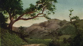
Hamilton Gulch
You are standing in Hamilton Gulch at the headwater of a major tributary of the South Fork of Strawberry Creek. This watershed originates below Chapparal Peak, near the intersection of Grizzly Peak Boulevard and South Park Drive at the highest point on the Berkeley ridgeline. Springs, seeps, and seasonal streams coalesce at this spot to create a wetland and riparian strip through the oak/bay woodland. Lots of birds are active here, including warblers, wrens, towhees, and song sparrows. This area is currently undergoing restoration, please read the interpretive sign for information on common plant species that you will see on your walk.
UC Botanical Garden
At this site, another tributary of the South Fork of Strawberry Creek flows under the trail. It originates from the broad canyon under Grizzly Peak (the second highest point on the Berkeley ridgeline), and it tends to have water year-round. In the UC Botanical Garden, this tributary is associated with the famous Japanese pool, a pond that serves as one of the last major breeding sites for newts (Taricha spp.) on the west side of the Berkeley Hills. Look at the largest trees that dominate the forest at this spot and along the trail, the majority are either coast live oak (Quercus agrifolia) or California bay laurel (Umbellularia californica). These are the two most common native species in Berkeley forests. Find one of the dark green, lanceolate leaves of a bay laurel, crunch it up, and give it a light whiff. How do you describe the sensation?
Strawberry Creek (South Fork)
Just below this location is the confluence of the three major tributaries of the South Fork of Strawberry Creek. You stand above the tributary that emerges from Strawberry Canyon Gate near Lawrence Berkeley National Laboratory Buildings 74 and 84, along Centennial Drive. This tributary is joined by a small, seasonal stream called Winter Creek that originates near School Pond above the Mather Redwood Grove in the Botanical Garden. Near the creeks, try to find two species of tree with large, palmate leaves, viz., California buckeye (Aesculus californica) and big-leaf maple (Acer macrophyllum). Both species are deciduous and the leaves turn brilliant yellow in autumn; the maples produce the helicopter-like seeds called samaras, and the buckeyes produce the heavy, fig-shaped fruits. As you walk along Centennial Drive to the next point, look for these species in the creek bottom to your left.
Going subterranean
Near this location, the South Fork of Strawberry Creek takes its first major trip below ground. At this elevation, the creek is forced through two pipes that shunt the water under the Strawberry Canyon Pool, the rugby field, and Memorial Stadium. Small reservoirs were once constructed here to hold water for the growing Berkeley campus, and long before that, the Huichin band of the Ohlone established seasonal camps along the length of the creek, from the headwaters to the permanent residences on the shore of San Francisco Bay. The Huichin people gathered mollusks, berries, and acorns, and they fished for salmon (Oncorhynchus tshawytscha) and steelhead (Oncorhynchus mykiss). As you descend to the bottom of Strawberry Canyon—or Strawberry Valley, as it is called on the old maps—reflect on the changes that this landscape has endured.
Hayward Fault
At this location, Strawberry Creek flows right across the Hayward Fault! Transpression at this fault lifts the land to the east helping to form the Berkeley Hills, and horizontal movement causes the land to the west to move northward at the rate of about 0.1 inch (2.5 mm) per year. A series of beautiful small waterfalls once occurred here where Strawberry Creek cascaded over the fault line. In the late 1800s, the mouth of the canyon was the site of dairy farms that supplied the campus community with milk and eggs. When Memorial Stadium was first constructed (in 1923), the geology of plate tectonics was not understood, and the fact that the shifting ground would inevitably disrupt the culverts of water under the stadium was not recognized. Expensive upgrades to the system have been necessary to keep the sewage from the stadium out of the creek. The last major earthquake on this fault was in 1868 and registered 6.8, and the USGS gives a 33% chance of a temblor of similar magnitude in the next 25 years. From this location at the toe of the canyon, look up toward the ridge, and note that the north side of Centennial Drive was clearcut: all eucalyptus, oak, and bay laurel trees were removed from the vicinity of the road in early 2020. The goal is to maintain a safe artery for cars to flee the hills in the event of a major fire.
California grizzly bear
The statue of a California Grizzly Bear gives you a good sense for the size of these beasts. Grizzly Bears are also known as Brown Bears, and both of these common names refer to the same species: Ursus arctos. Across its wide range in the northern hemisphere, Ursus arctos evolved many local variants, and historically, many taxonomic subspecies were recognized, including the California Grizzly Bear (Ursus arctos californicus). The word “grizzly” was probably a reference to the “grizzled” appearance of this big bear’s fur, as the long brown hairs are tipped with light brown or, generously, gold. California grizzlies were systematically exterminated in the late 1800s with modern weaponry, and the last grizzly of the Berkeley Hills was encountered in Strawberry Canyon in the late 1800s, near what is now known as Grizzly Peak. Cal’s athletic teams adopted the Grizzly Bear as a mascot after the track team rose to national prominence in 1895. To the south, note that a grove of coast live oaks anchor the ground in front of the stadium. These trees represent a remarkable remnant of an old-growth woodland, eking out an existence at the wildland–urban interface.
Haas native plants
Now we find ourselves on the fully urbanized landscape of the UC Berkeley campus. Strawberry Creek remains below ground at this elevation, but we are surrounded by life, including a nice selection of native plants on the steps that lead down from the Haas School of Business. Among the young coast redwood trees, try to find the species of small tree with deep green, leathery leaves with serrated edges. This is toyon (Heteromeles arbutifolia), a widespread species that flourishes in the Mediterranean climate of California. Toyon produces clusters of bright red berries in the winter, and it also called Christmas berry or hollywood (yes, the name of the Los Angeles neighborhood was borrowed from this tree which once grew prolifically there). You should also try to find a small shrub here with similar deep green, leathery leaves, although the edges of these leaves are smooth, lacking sharp teeth. This is coffeeberry (Frangula californica), and it produces plump berries that turn from dark blue to black as they ripen. Even in a concrete jungle such as the steps of Haas, a nice selection of native plants can provide a powerful connection to the local landscape.
Women's Faculty Club
Strawberry Creek re-emerges! In this shady spot under a heavy canopy of redwood trees (Sequoia sempervirens), the creek flows back to the Earth’s surface. A few bay laurels break through the heavy duff as small seedlings, and the spot has the feel of a northern California coastal forest. American Crows and Steller’s Jays can be seen or heard in the branches above, and Brown Creepers and Red-breasted Nuthatches might be working on the tree trunks in search of insects. After its long passage below ground, Strawberry Creek starts to pick up natural organic content at this stage, especially in the areas where the banks are well-developed with vegetation, and where the floor of the creek is earthen rather than an artificial hardbed. Architecturally, the brown-shingled Women’s Faculty Club appears particularly well integrated here.
Creekside marsh
This beautiful patch of wetland sits within the Goodspeed Natural Area, one of the three designated green areas on central campus. The diversity of plants at this spot includes sedges, rushes, grasses, and other herbaceous plants near the creek bottom, as well as a couple big ferns higher up on the bank. A big-leaf maple sapling grows inside a protective cage, and the redwoods tower overhead. Juncos, wrens and Song Sparrows flit about in the streamside vegetation. The university’s active investment in stream rehabilitation is evident in spots like this. In the early 1900s, the Berkeley campus was known for its stench, as raw sewage was disposed directly in the creek, including from the student cabins that were built streamside. The log cabin on the south side of the creek, Senior Hall, harkens back to a previous era. The building was constructed for the semi-secret society known as the Order of the Golden Bear in 1906, and it long served as a social space for the male student body. Senior Hall was constructed by the First Dean of the College of Architecture, John Galen Howard, whowas also responsible for the beaux arts design of the Campanile, Doe Library and Wheeler Hall. Howard was inspired in his architecture by themes of the California landscape at the time of nascent statehood. However, administrators worried the structure made Berkeley appear too provincial, and the building's redwood logs and rustic frame were regarded by some as a blight on the campus. Howard’s successor as campus architect, Julia Morgan, designed a complementary structure on the opposing bank of Strawberry creek to provide community space for the female students. In 2014, that building, called Girton Hall, was relocated to the UC Botanical Garden. Today, both spaces continue to serve as important hubs for campus and student life.
Faculty glade
This is a deeply resonant spot on the Berkeley campus with a lot of tradition. Archaeological evidence suggests that this site was once occupied by an Ohlone homestead. The creek — which was once lined with wood strawberry (Fragaria vesca californica), California rose (Rosa californica), and riparian trees — has been re-shaped and re-planted. The famous gnarled buckeye tree that grows here was planted in 1882, and the stone bridge was donated by the class of 1910. This site was landscaped like an English garden, with pittosporum, azaleas, and English ivy (Hedera helix). This spot is rich with birds and active with Eastern Fox Squirrels (Sciurus niger) that bury acorns on Faculty Glade (4.0 Hill). The site has served as a natural amphitheater for gatherings and performances for many years.
Sather Gate
This charming spot along Strawberry Creek is next to Sather Gate, the original entrance to campus from the south. The North and South Forks of Strawberry Creek initially formed the campus borders, with central campus established between the flowing waters. Redwood trees did not occur naturally along Strawberry Creek, although they grew abundantly in the Oakland Hills and in isolated patches throughout the East Bay Hills. The big redwoods at this location, as in other spots on campus, were transplanted from Mendocino County in 1905, so they have grown to this stature in just over a century. The beautiful brick building visible up creek is the Old Art Gallery, which is now being converted into a small concert hall. Take a moment to reflect on the way that the campus bustle mingles with the sound of the stream. You are a stone’s throw from the birthplace of the Free Speech Movement in the late 1960s. Everything comes together at this spot: politics, ecology, music, art.
Riparian redwoods
You are standing above Strawberry Creek on Bay Tree Bridge. Up and down the creek from this location are redwoods and coast live oaks that anchor the stream banks. The bricks from the old student cottages that once lined this part of the creek can still be found on the creek bed, and water rages here during major rain events in the winter. As the artificial rock surfaces lining Strawberry Creek are replaced with natural organic structures, the absorption of rainwater is improved, and aquatic organisms have a greater likelihood of surviving the seasonal flush by sheltering in stems, roots, and interstices. Although migratory salmon and steelhead have not been seen in Strawberry Creek since 1930, a few native fish species were reintroduced to Strawberry Creek in the late 1980s, including California Roach (Hesperoleucus symmetricus) and Hitch (Lavinia exilicauda).
Memorial Bridge
At this bustling corner of campus, you find yourself on a stone bridge over the South Fork of Strawberry Creek, not far from the confluence with the North Fork. Several spectacular California buckeyes line the banks of the creek here, and these trees are fabulous year-round. In spring/summer, the big, palmate leaves burst forth with sweet-scented flower panicles, and in fall/winter, the pendulous fruits hang from the bare, deciduous branches. To your right are the life sciences buildings. When campus was first established, a Middle Fork of Strawberry Creek meandered through the meadowy flat that once occupied this space. The Middle Fork wetland was drained and filled in 1877 to create a cinder running track for the Cal track team, and a grove of blue gum trees (Eucalyptus globulus) was planted in 1882 to block the foggy wind that blew from the west. The blue gum trees flourished, drinking the fog in summer and the rain in winter, and they soared in height. By some accounts, these are the tallest hardwood trees (angiosperms) in the United States! As you make your way into the Grinnell Natural Area, you can reflect on the loss of the marshy central branch of Strawberry Creek and the fact that this wetland is no longer available to help absorb the heavy precipitation of winter.
Confluence and mainstem
You are now approaching the confluence of the South and North Forks of Strawberry Creek! The confluence is a magical spot, in the urban park sense. You might see a bit of garbage on the ground, but you will also find some amazing natural history. Locate the dense patch of creek dogwood (Cornus sericea) that covers the confluence of the two forks of Strawberry Creek. Duck inside this leafy hut and experience the confluence directly. Follow the North Fork upstream, and you will find California rose (Rosa californica), thimbleberry (Rubus parviflorus), and other members of the original riparian plant community. Look for water striders (Aquarius remigis) on the creek surface, as well as the crayfish that ply the creek bed (Pacifastacus leniusculus). If you would like to do so, you can follow the North Fork up to its source under Little Grizzly Peak. The North Fork is visible in a beautiful, shady grove at the top of Leconte Avenue near Kingman Hall. It then runs under Euclid and Hearst Avenues to emerge in the Chancellor’s Garden (inaccessible to the public). The water then follows the redwood forest through the Wickson Natural Area and meanders across the grassy glade between Wellman Hall and the Valley Life Sciences Building. The North Fork dives below the West Circle with its giant eucalyptus tree, and it re-emerges here before its merger with the South Fork.
Leaving campus
The Main Branch of Strawberry Creek has coalesced here from its many seeps, springs, and tributaries up slope. At this location, it was once possible to gaze through the Golden Gate on a clear day. A plaque here commemorates the 1772 Spanish expedition when the beauty of the location was first described by Europeans. But this is Ohlone tribal land. For millennia, indigenous Americans fished, foraged, and profited on this landscape without breaking the Strawberry Creek ecosystem. The Spanish isolated the indigenous populations on reservations, and the land was ultimately subdivided for private ownership. The University of California chose this location for their future campus specifically because of the availability of fresh-flowing water in Strawberry Creek. There followed a century of mismanagement, with the headwaters channeled into reservoirs and the lower reaches used as an open sewer. Roads and buildings prevented the natural absorption of rainwater in winter, and flash-flooding and creek-bank erosion became an expensive hazard. Dozens of check dams were built to mitigate flow, and the beds and banks of the creeks were lined with stone and cement in an attempt to maintain control. The environmental movement of the 1960s led to a new ecological sensibility, and the Strawberry Creek ecosystem has benefited. Follow the creek as it passes through a heavy grate and disappears under Oxford Street. It will continue below Berkeley, flowing between Allston Way and Addison Street for a full mile before it sees daylight again.
Strawberry Creek Park
Strawberry Creek Park is a hidden gem in the neighborhood of Berkeley known as Poet’s Corner. Here, beautiful Strawberry Creek returns to the open air as a result of a 1977 “daylighting” project that became an international model for the rehabilitation of urban streams. Strawberry Creek Park runs north-to-south along a former railway that once served travelers between Berkeley and Chicago. You can see the old train depot one block to the north (the building with the circular dome roof, now a Montessori School). Find a spot near the bank of Strawberry Creek where it emerges from under the bridge. Note that the floor of the creek below here is constructed from the rubble of the old cement culvert—when they daylighted the creek, they recycled the old material to form the creek bed! They also kept most of the displaced soil on the site, thereby minimizing the overall cost of the project. A couple of beautiful cottonwood trees (Populus fremontii) grow here, and a new playground has just opened to the public on the south side of the creek. An amazing café hosts live music on the weekends, and a pasta shop that serves fresh bread and baked treats—try a loaf of olive bread or a pecan cookie). On the site of an old railroad, along a creek that once ran through a cement pipe, this location is as charming and inspired as it gets in the heart of Berkeley.
San Francisco Bay
It has been a journey, but Strawberry Creek has finally reached the sea. In a previous era, this shoreline was a rich estuary, with Strawberry Creek being one of several creeks that drained the East Bay Hills into San Francisco Bay. The freshwater streams mix with the saltwater to create fertile, brackish ecosystems that support a vast number of algae, plants, birds, mollusks, crabs, and fish. The tides invigorate the mudflats, and life is concentrated at the mouth of the creek. Ducks, geese, and gulls congregate where Strawberry Creek emerges, as the birds jockey for position to have a proper bath. Three-spined Sticklebacks (Gasterosteus aculeatus) swim in these flows, and along the muddy banks, the footprints of Raccoons (Procyon lotor) and California Ground Squirrels (Otospermophilus beecheyi) mingle with those of egrets and herons. One of the largest Native American communities of the West Coast flourished on these banks for millennia. Huge mounds formed where the people lived, died, and buried their loved ones. These shellmounds were unceremoniously bulldozed in the race to urbanize, and only a few intact shellmounds remain. Standing here at the mouth of Strawberry Creek with a strong sense of place, we do well to reflect on what it means to be an ecological citizen on an interconnected planet.