Tiaki Promise
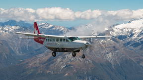
Introduction to your flight with Glenorchy Air
Haere mai, and welcome aboard your Glenorchy Air scenic flight to Piopiotahi | Milford Sound—one of the most beautiful regions in our beloved Aotearoa! Whether you’re joining us in the air or from the comfort of home, we’re thrilled to guide you through the remarkable landscapes of Queenstown and beyond.
Before we begin today’s journey, a friendly reminder: please listen to and follow all crew instructions as required by New Zealand Civil Aviation Law. Your safety, along with that of your fellow passengers and crew, is our top priority. Today you have opted to enjoy our commentary via the app. It is designed to activate automatically as we pass through points of interest. Our scenic flights are weather dependent so today’s route may differ slightly from this one, but rest assured you’ll be in for an incredible scenic flight on every carefully chosen flight path.
Our usual flight path begins in the Wakatipu Basin, where the remnants of Queenstown’s gold rush era are still recognised throughout the landscape. As we reach altitude today, we’ll cross the majestic Southern Alps, flying over Mt. Aspiring National Park and into Fiordland National Park. From ancient glaciers to tales of discovery, we’ll explore the geological and cultural stories of these awe-inspiring landscapes. Sit back, relax, and let the unparalleled beauty of Aotearoa New Zealand give you a front-row seat to nature’s finest show!
Dalefield and Coronet Peak
As we ascend, we cross the Kawarau River, the only outlet for the deep waters of Lake Wakatipu. Below us, Dalefield stretches out, its terrain is scattered with luxury homes offering stunning views. Known as one of Queenstown’s most exclusive suburbs, properties here average 5.5 million NZD. Among its famous residents is actor Sam Neill, who not only graces our screens but also produces a delightful Pinot Noir under his label, Two Paddocks—a must-try for wine lovers.
Ahead of us lies Coronet Peak, New Zealand’s first commercial ski field, which opened in 1947. Its proximity to Queenstown makes it the most accessible ski field in New Zealand through winter and in summer it offers some epic mountain biking trails! When all its snow machines are blasting; Coronet Peak ranks as the second-largest electricity users in the South Island.
Skippers Canyon and Queenstown’s rich history
Next, we fly over Skippers Canyon, a rugged and storied place that was once a hub of gold mining during New Zealand’s gold rush. In 1862, William Rees and his worker stumbled upon gold in the Shotover River, kicking off a frenzy. Local lore tells of his sheepdog emerging from the river with its paws dusted in gold —a discovery they managed to keep secret for years.
When word inevitably got out; the Shotover River, dubbed "the richest river in the world" during its peak, attracted miners from Europe and China. The miner’s history is preserved in remnants of tools, settlements, and the nearby Arrowtown—a treasure trove of gold rush-era tales. The pine trees you’ll see across the Queenstown region today were also introduced by the miners because they grow quickly and spread rapidly making them ideal resources during the era. The trees are an introduced species and considered a pest in New Zealand, and the goal is to eradicate these as quickly as possible as they grow 4 times faster in NZ than anywhere else in the world.
The Richardsons, Glenorchy, and the Dart & Rees Rivers
We are now crossing the Richardson Mountain Range, the first of three ranges between Queenstown and Milford Sound. In the distance out of the right-hand side of the aircraft we see the iconic Tititea | Mt. Aspiring with its distinctive prism-like peak. During winter, Glenorchy Air offers sunrise flights around Mt. Aspiring, showcasing the most breathtaking sunrises our country has to offer.
On clearer days, Aoraki | Mt. Cook, New Zealand’s tallest mountain, may be visible on the horizon. Known in Te Reo Māori as the "Cloud Piercer," its peak stands prominently among the Southern Alps. The mountain is recognisable from where we are by its square ridge line. A day trip to Aoraki | Mt. Cook National Park is highly recommended; it is approximately 4 hours each way by road or an hour each way by scenic flight with us.
As we move into the next valley and the Northwestern parts of the Wakatipu Basin; the Dart and Rees Rivers lead us to the picturesque township of Glenorchy. Home to around 400 people, this tranquil spot offers thrills like jet boating with Dart River Adventures or multi-day horse treks with High Country Horses. Be sure to visit Miss Wooley’s General Store for an iconic New Zealand pie—you won’t regret it!
This region also boasts a cinematic legacy, featuring prominently in films like The Lord of the Rings and Mission Impossible.
Harris Saddle, the Routeburn Valley and the Main Divide
Below lies the Routeburn Valley, home to one of New Zealand’s Great Walks. The Routeburn Track covers 32kms, spans three days and then ends at the Hollyford Valley, where we’re headed next. This track is one of three great walks in the region alongside the Keplar Track and, the Milford Track; the most famous of the New Zealand Great Walks in this region. In fact, the Milford Track is so popular that tickets for its huts often sell out in under 10 minutes each season!
The Hollyford Valley marks our transition to the West Coast or west of the main divide. Follow its path, and you’ll find Lake McKerrow—a serene slice of nature reaching out to the coastline. This is where you see the landscape changes from Very brown and dry to very green and lush
The Tallest Mountain in Fiordland
Ahead rise the striking peaks of Mt. Tutoko and Mt. Madeleine. Mt. Tutoko, the tallest in Fiordland National Park, stands just under 9,000 feet (approximately 2750 metres) and is named after a Māori chief who once cared for this land. The glacier on the north face is called the Don Glacier and the South Face is called the Age Glacier. To the left is Lake Turner and the Turner Falls and to the right is the Tutoko ice plateau, a flat top peak covered in glacial ice. Keep your eyes peeled for Helicopters as they do sometimes land on the glacier.
The West Coast and our descent into Milford Sound
We’ve made it to the West Coast of our beautiful country and will begin our final descent through the fiord before landing in Milford Sound for your cruise experience with Southern Discoveries. If you squint your eyes out to the horizon you will be able to make out Australia, just joking of course!
Australia is approximately one thousand miles across from where we are now and would take around seven hours to fly to in this aircraft with Melbourne being the nearest city.
You’ll notice the landscape looks very similar to a rainforest and you wouldn’t be wrong thinking that. Milford Sound is classified as temperate rainforest, receiving 7-8 metres of rain per year. That’s approximately ten times what Queenstown gets and is the reason for the lush greenery across the landscape.
When Captain Cook first sailed past Milford Sound, he wrongly identified Milford Sound as a bay and kept on going, in fact he missed the entrance to it twice! Finally, in 1823 a sealer called John Grono became the first European settler to visit Milford Sound and he named it after Milford Haven in his home country of Wales.
Milford Sound
Welcome back onboard your flight with Glenorchy Air, we hope you enjoyed your cruise of Milford Sound with Southern Discoveries. It is now time to buckle up and get ready as we show you some more sites and share some more stories on our way back to Queenstown.
As we depart the area you’ll see the large peak in front of you. That is Mitre Peak, and it was carved out by glaciers over tens of thousands of years. Mitre Peak is one of the world’s tallest sea cliffs it is 6500 feet (approximately 2000 metres) from top to bottom with 5500 feet (approximately 1700 metres) standing above sea level. Off to the right by the cruise terminal you will see Lady Bowen falls, this powerful waterfall supplies all of Milford Sound’s drinking water as well as its power.
The Arthur Valley, Mckay and Sutherland’s coin toss
We are now leaving Milford Sound via the Arthur Valley; this is the very end of the Milford Sound great walk, with the final part being named Sandfly Point.
Back in the late 1800’s a cartographer named Donald Sutherland began exploring Milford Sound and the surrounding area. Aptly named the “Hermit of Milford Sound”; Donald lived alone in Milford Sound for 17 years before he married and was joined here by his wife. Sutherland was responsible for charting out the area and documenting it for others, he worked with a man James McKay who would assist him in his work.
On one of their explorations, McKay and Sutherland tossed a coin and the winner would get to name the first prominent terrain feature that they discovered. McKay ended up winning this coin toss and named the McKay falls on the western side of the valley about halfway up. This of course meant that Sutherland got to name the next one and, in our opinion, he got the better end of the deal. The next waterfall they came across is the most impressive waterfall that the Fiordland National Park has to offer and will be coming up to shortly.
Sutherland Falls
The Sutherland Falls is indeed the most impressive waterfall the Fiordland national park has to offer. It falls in three stages and is fed by Lake Quill at the top, the source of the Falls. When Donald Sutherland discovered the waterfall, he initially estimated the total height to be over 3280 feet, (approximately 1000 metres). Later it was measured to be only around 1900 feet or 580 metres so, Sutherland was either bad at gauging height or wanted to inflate the figures to make his discovery seem more significant!
Lake Erskine
To our left we have Lake Erskine. The lake sits at 5000 feet (approximately 1500 metres) high in the mountains and is 1.2 miles or 2kms long. It is one of the highest and largest alpine captive lakes in Fiordland. Like many of Fiordland's lakes, Lake Erskine was formed by glacial activity during the last Ice Age, where glaciers carved behind deep valleys eventually filling with fresh water. The lake is accessible by helicopter and is a popular backdrop for wedding photos.
Lake Gunn and the Eglington Valley
To our right we will be looking down into the Eglington Valley, with the large plains of grass that you can see named the Eglington flats. And to our left we have Lake Gunn, Lake Fergus and the Hollyford valley. Weaving through the valley down below you may be able to also spot the Milford Road, which is the road you would take if you were driving to Milford Sound. For the people driving today you can expect a 9-hour return trip between Queenstown and Milford Sound. However, lucky for us it is just 35 to 40 minutes to fly each way.
Elfin Bay and Lake Wakatipu
The conclusion of our journey begins back at Lake Wakatipu which we will be following on our way through to Queenstown. Lake Wakatipu is New Zealand’s longest lake at 84 kilometres or 52 miles long. Its deepest point of 380 metres which is taller than the Auckland Sky Tower. Due to the depth of the lake and being fed by glacial ice melt the temperature of the lake only changes by a few degrees during the year the average temperature being about 10 degrees Celsius . One of the interesting phenomena of Lake Wakatipu is its 'tide' or more correctly, standing wave, or seiche, which causes the water to rise and fall about 10 centimetres every 25 minutes or so. Māori legend links this phenomenon to the heartbeat of a huge monster named Matau, who is said to be slumbering at the bottom of the lake.
On Lake Wakatipu you’ll see three islands. We have Pigeon Island which resembles a Pigeons head, Pig Island which looks like a pig’s trotter and the smallest of the three, Tree Island, ironically named as it doesn’t have a single tree on it.
The Lady of the Lake and our descent into Queenstown
As we track along the lake you’ll see Mt. Nicholas station on your right, a 100,000-acre station just over half the size of Singapore. Mt. Nic is a high-country merino station providing wool for the likes of Icebreaker and Swanndri. On your left-hand side you’ll see Bob’s Cove, a popular spot for locals in summer to take their paddleboards and kayaks out. Above that you’ll see Lake Dispute; the lake was named after a Goldmining dispute relating to Great Grandfather of Glenorchy Air’s founder, Robert Rutherford.
If she’s not docked at Steamer Wharf, you may be lucky enough to see “The Lady of the Lake” also know at the T.S.S Earnslaw, the beloved Edwardian twin screw steamer built in 1912; the same year as the titanic sunk. Originally, the vessel was used for transporting livestock and goods to the small settlements around Lake Wakatipu. In the late 1960s the vessel was very nearly scrapped but found her way into tourism making trips from Queenstown to Walter Peak station for an exceptional BBQ lunch and dinner.
With five to ten minutes left before we land it is time for us to say goodbye. It has been an absolute pleasure to join you on your Milford Sound experience and on behalf of Glenorchy Air and Southern Discoveries we’d like to say thank you for choosing us. Please ensure your seatbelts remain securely fastened and you have all your belongings! We welcome you to sit back, relax and enjoy the scenery around the Queenstown lakes area.
If you have any feedback about what you’ve seen or heard today, please feel free to share it with us on Google, TripAdvisor, or with the pilot who flew you today. If you’d like to understand about any of our other scenic flights chat to a member of the team once we land.