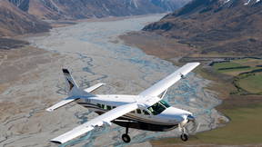
The Grand Traverse - English Preview

Access this tour for free

Experience this tour for free. Available through our app.

Download or access the app

iOS Android Web

Safety Message & Pre Departure Scenic Info

Please fasten your seatbelt for takeoff.

1

Tekapo Township (catchment trees)

Nestled around the southern shoreline of Lake Tekapo is the Tekapo Village, it is home to approximately 550 permanent residents.Lake Tekapo has some of the clearest and darkest night sky in the world and is home to the Mt John Observatory housing the biggest telescope in NZ, the 1.8 metre MOA. Built in the 1960’s the observatory is now mainly used for research purposes by the University of Canterbury.In 2012 an area of 1700 sqmiles around the observatory was declared as the Aoraki Mackenzie International Dark Sky Reserve.

2

Lake Alexandrina (South Of Island)

To the west of Lake Tekapo is Lake Alexandrina. Famous for Rainbow and Brown trout fishing this spring-fed lake is a striking contrast to the turquoise-blue glacial water of Lake Tekapo. The lake is one of New Zealand’s Scenic Reserves with over 40 species of birds within its biologically rich catchment. Rowing boats are the only mode of transport on the lake as sail and motor boats are prohibited.

3

Lake Tekapo (over Island)

Glaciers grinding against rock in the head waters of the Godley Valley produce a fine ‘rock flour’ that when washed into Lake Tekapo creates it’s unique turquoise-blue colour.120 metres deep and with an average temperature of 7°C, Lake Tekapo is the first in a chain of 7 lakes providing hydroelectric power to all of New Zealand. During the summer months Lake Tekapo is popular for waterskiing and other watersports as well as trout and salmon fishing.

4

Sheep Stations (north of island)

On both sides of Lake Tekapo are high country sheep stations which extend up to the top of the surrounding mountains. West of Lake Tekapo are Glenmore and Godley Peaks Stations. Both these high country sheep stations are 50,000 acres in size. They each farm approximately 10,000 merino sheep, a breed famous for it’s super fine wool and ability to survive in harsh environments. They graze high on the mountains during summer and are mustered on foot by shepherds and their dogs to the lower country for the winter months protected from the deep winter snows.

5

Head of Lake Tekapo

Feeding into Lake Tekapo is the Godley River. Carved out by the glacier which formed Lake Tekapo the shingle valley floor is over two kilometres across and criss-crossed with river channels – the famous South Island “braided” river system. Black Stilt, one of worlds rarest birds, nest and feed within the channels, well protected from predators.

6

Sibbald Range (north branch Godley)

Flanking the eastern side of the Godley Valley is the Sibbald mountain range with Mt Sibbald the dominant peak at 9,200feet. This range clearly shows active erosion – typical of the geologically young Southern Alps. Musterers’ huts, seen in the valleys below, are used for accommodation and shelter during autumn musters on the sheep stations. There are also many sporting animals in this area including Chamois, Himalayan Tahr and Red Deer.

7

Godley Lakes

At the headwaters of the mighty Godley River, you will see the isolated Classen and Godley Glaciers’. At their bases are the large terminal lakes – frozen over during the winter months. In summer you can occasionally see icebergs floating in the lakes that have broken off the glaciers melting to fed the Godley River.

8

Murchison Glacier

Below is the Murchison Glacier, at 16 km long the Murchison is New Zealands’s second largest glacier. Flowing in parallel valleys, the Tasman and Murchison Glaciers are separated by the Malte Brun range, dominated by Mt Malte Brun at 10,400 feet.

9

Head of Tasman Glacier

The mighty Tasman Glacier below is the longest glacier in New Zealand, flowing 27km down the Tasman valley past Mount Cook at a rate of about 0.5 of a meter per day! The upper parts of this glacier are very popular for skiing and climbing; can you see any climbers today?

10

Franz Josef Glacier

Below us the Franz Josef Glacier plummeting steeply westward, this magnificent river of ice descends almost to the Tasman Sea at a recorded rate up to 4.5 meters per day, the snow and ice around us is 6-700 meters deep and the crevices you can see below demonstrates that this is an actively moving glacier.

11

West Coast Rainforest

The Southern Alps stands like a fortress wall in the path of the moisture-laden westerly air flowing in off the Tasman Sea. The weather is very changeable here on the west coast; on a good day to the west you will see 300km of coastline. On a cloudy day from above “the coasters” are likely to be contributing to their annual rainfall of 5 meters per year! This mix in weather allows for one of New Zealand’s most dense areas of rainforest.

12

Fox Glacier

The Fox Glacier below, maori understanding of the alpine world was based on great myths to enable generations to commit to memory the unique landforms of the area. The Maori name for Fox Glacier, “Te Moeka o Tuawe” was derived from ancestor Tu Awe who fell to his death while exploring the area. The bed of the glacier was his final resting place and it is said that when his lover Hukatere wept, the bed of the Fox and Franz glaciers filled with her everlasting tears of ice. The Fox Glacier moves abit slower than the Franz at around 1.5 meters per day.

13

Mt Tasman (west side)

Mt Tasman to your east is New Zealand’s second highest mountain first climbed in January 1895, its stands at 11, 475 feet or 3,497 Meters tall.

14

Mt Tasman (East Side)

Mt Tasman to your west is New Zealand’s second highest mountain first climbed in January 1895, its stands at 11, 475 feet or 3,497 Meters tall.

15

Mt La Perouse

Mt La Perouse, a beautiful peak dominated by its huge southern rock face. In 1948 La Perouse featured in one of the last big ground rescues ( before the use of helicopters) – an injured climber was successfully rescued from near the summit in an epic effort over 6 days.

16

Aoraki Mt Cook

Aoraki Mt Cook, Aoraki standing for the “cloud piercer” New Zealand’s highest mountain stands supreme with its snow and ice fields spilling into the glaciers below. First climbed on Christmas day 1894 by 3 locals from Timaru with the youngest being just 18 years of age. Back in 1991 a giant rock avalanche occurred on Mt Cook lowering the highest peak by 20m Today it stands at 12,316 feet or 3754 meters high. We will position the aircraft for your best photo opportunities please have your cameras ready to get the best view of Aoraki Mount Cook, Our highest mountain.

17

Tasman Glacier / Tasman Terminal

You are now looking right up the 27 km of Tasman glacier from the south end, New Zealand’s Longest glacier. At its terminus is a glacial lake, 150 m deep and lined with ice, feeding into the huge braided Tasman River, the icebergs in the lake have taken about 500 years to travel from the neve at the top of the Tasman glacier to where they appear today. Underneath this lake the ice is still 200 m thick!

18

Forks Valley

This valley system below us is very popular with hunting; these hills are home to the himilan tar, which just runs freely on these slopes. They are very hard to see but look out for the tracks that they leave behind.

19

Mackenzie Basin

Approximately 16000 years ago the ice that covered this area from the last ice age began its retreat- today golden tussock and grasslands cover the glacial deposits that remain clearly visible from the air. Dramatic ice covered landscape, subtle ever-changing hues, and air of exceptional purity – just some of what makes the Mackenzie so special. Its average rainfall is just 63 cm per year, a lot less than the 5 meters the west coast gets.

20

Fasten seat belts pre landing

21

Waiho rover mouth

22

Lake Muller

23

Bottom of the Fox Glacier

24

Franz Josef Village

A new place

The Grand Traverse - English
24 Stops
45m
200km
0:00
/
0:00