The Three Kings Pump house
Three Kings Reserve, 1011 Mount Eden Road
Mt Roskill Road Board formed a water and gas committee in 1899, and from 1902 to 1915, the district’s water supply was obtained from the Manukau Water Trust’s reservoir at One Tree Hill.
In 1911, increasing development in the area necessitated a local water source. The road board called in Rev Harry Mason, a sought-after local water diviner, to locate a site in Three Kings that would provide a good water supply. A borehole at the reserve at Three Kings found water 21m underground, and test bores produced about 3785 litres of water per hour. The board confirmed this as the site for a new municipal pumping station.
The road board’s engineer, J Dawson, designed the waterworks facility and construction was approved in 1915. The Three Kings Pumphouse was formally opened on March 27 1915 by John Peet, the road board chairman.
The significant typhoid outbreak in Mount Albert in 1922, thought to have been caused by sewage contaminated water, spelled the end of the pump house. Schools in the area were forced to close and local residents were advised to boil all milk and water prior to consumption. At the same time, as a precautionary measure, the public health authorities ordered the closure of the pump house.
The pump house building later became Mt Roskill's first community hall. A kitchen, ladies’ cloakroom and porch were added to the northern wall and it became a popular spot for dances, parties, social gatherings and local theatrical productions.
During the 1950s the hall was used by the Auckland Boxing Club, and the interior was altered again for its purposes.
In 1958, the Mt Roskill Municipal Band was granted sole use of the pumphouse building. Further alterations took place during 1958-1959. The kitchen to the south was demolished, and the ladies’ cloakroom was converted into a kitchen. The eastern gable circular window was cemented and plastered over. A ceiling of slatted timber was nailed to the underside of the kauri trusses to improve acoustics for band practice
The building was restored by Mt Roskill Borough Council in 1988 and today it is in use by the Auckland City Brass.
Concrete Villa (private residence, do not enter)
520 Mount Albert Road
The Edwardian villa at 520 Mt Albert Road is likely to have been built between 1908-1914 on land purchased by prominent local resident James Preston in 1908. Preston, who was well known in the Auckland horse racing scene, served on the Mt Roskill Road Board from 1918 and also chaired the local school committee for nearly two decades.
The house provides evidence of early 20th century development in the Three Kings area, together with the Mt Roskill Congregational Church opened in 1907, the Ranfurly Veterans’ Home established in 1903, and the “Coleraine” Logan Manor at 1 Warren Ave built in 1905.
It is a good local example of an Edwardian plastered brick villa. Although it has had some modifications, it retains evidence of its original form, materials and detail. The house is distinctive within the surrounding context because of its form, style and elevated position.
Former Mt Roskill Fire Station (private residence, do not enter)
504 Mount Albert Road
It was during the early 1900s, in the years of rapid development in the Three Kings district, that a dedicated volunteer fire brigade was first proposed for the area. However, the idea never eventuated.
It wasn’t until several years later that the proposal was again raised by local residents. A small fire had broken out in a cowshed at the Ranfurly Veterans’ Home on Mt Albert Road, and no help was available. Even the nearby district fire brigades refused to assist. The incident provoked yet another public appeal to the Mt Roskill Road Board, which refused on the basis of insufficient funds. Instead, the Road Board began working on an agreement with the nearby Mt Eden Borough Council and Onehunga fire brigades to respond to call-outs in the western and eastern parts of the Mt Roskill district, respectively. This arrangement commenced and the district relied on fire support from their neighbouring districts for several years.
In late 1925, the Mt Roskill Road Board confirmed that it was time for a fire station to be built in the district. The road board appealed to ratepayers for a loan proposal for the project. By August 1926, a Mt Roskill Fire Board was formed and in October the same year they began the process of planning for the district’s first fire station.
The Mt Roskill Fire Station was designed by Gerald E Jones and Arthur Palmer and constructed in 1927 at a cost of £3111. It was opened on 10 December 1927 by Sir Maui Pomare, who at the time was the acting Minister of Internal Affairs.
The generous ground floor of the station accommodated two fire engines, and the gates were ‘fitted with modern automatic trip-action releases’. In the upper floor was a social space with a board room and mess rooms. Living and sleeping accommodation were provided for the officer in charge and two firemen. Alterations were made to the living area in 1959, and there is evidence of an earlier extension to this part of the building. At the time Mt Roskill had a total approximate area of 5000 acres, with around 5000 residents, in 1900 houses.
In 1970 the property was subdivided by the Auckland Metropolitan Fire Board, leaving less than half of the original site. By 1980, the station also served as the district’s ambulance base.
On 11 September 2009, a new $4.9 million station was opened on Dominion Road, and the old station was put on the market in April 2011.
Keith Hay House (private residence, do not enter)
403 Mount Albert Road
This home was built in 1945 by the former Mayor of Mt Roskill Borough (1953–1974) Keith Hay. ‘Keith the builder’ was a successful businessman with a 42-year-long parallel career in local politics. After just one term in council, Hay was elected mayor in 1953.
He was influential in making cheaper building materials such as native pine permissible, and a supporter of low-cost housing initiatives in the area. Under Hay’s entrepreneurial leadership, the council improved basic amenities and the semi-rural district of Mt Roskill grew to become the country’s largest borough.
Several additions and alterations were made to the Hay home in the 1950s, including the addition of a second storey. In 1977, Hay’s house was transferred to the Zion Bible Training Centre and further modifications were made. In 1985 it was used by Rodney Funeral Home Ltd and then later, the Salvation Army. The house was sold to a private owner in 2002.
Grinter Building
503-507 Mount Albert Road
The Grinter brothers - Tom, Jim and Frank - purchased and flattened a hilly corner site on the corner of Mt Albert and Hayr roads in 1928, to build the district’s first service station and several shops. They operated the Three Kings Service Station on the site for close to 50 years.
The Grinter Brothers were prominent early developers in the area. Their service station is associated with early bowser service station design, and early retail development in Three Kings area. It is also associated with increased car ownership in the 1920s and ‘30s.
Prior to the development of their service station, the Grinters would load their trucks with petrol from huge tin drums. It was a tricky process. The drums would be propped on a tripod, then pushed down onto a spike that released the gas into a hose, which then drained into the trucks’ tanks.
The space above the shops was originally occupied by one of the Grinter women, but became the Electorate office of Labour MP Phil Goff in 1998.
Three Kings Congregational Church
513 Mount Albert Road
The Mt Roskill Congregational Church was constructed in 1907 on a small section of land gifted to the Congregational Union of New Zealand by a friend of the church, Samuel Scarborough. It was originally intended as a Sunday school hall and church.
As one of the earliest community buildings in Three Kings, after the construction of the Veterans’ home, it served as an important public meeting place during the early 20th century. A church fellowship was formed in 1912 with 11 members, and the membership became a part of the Congregational Union of New Zealand in 1913. Some veterans’ home residents attended the Sunday services.
The church has undergone several significant modifications over the years. In 1913, a lean-to was added to the southern side of the church building to accommodate three new classrooms for more than 90 students and eight teachers. Further alterations took place between 1955 and 1957, including an extension to the Mt Albert Road side of the building. In 1982, more alterations were made to the original church rooms.
In 1946, the name of the church was changed from Mt Roskill to Three Kings. While most of the congregational churches in Auckland became Presbyterian in 1969, Three Kings Church was one of the exceptions.
In 1980, the church purchased a house and property adjacent to the building for use by the church community. Many years later in 2010, the house was demolished to make way for a modern church centre building and car park. The building’s roof and 1955 extension was restored in 2013.
Three Kings Congregational Church continues to hold regular Sunday services which are attended by a multi-cultural congregation.
Women’s Suffrage Memorial
537 Mount Albert Road
Rose Park, on the corner of Warren Avenue and Mt Albert Road, was formerly the site of the first store in Three Kings. A store was established here in 1903, mainly to service the nearby Veterans’ Home, and later became a post office and telephone bureau.
A striking suffrage memorial was unveiled here on 19 September 2013, on the 120th anniversary of Women’s Suffrage in New Zealand. New Zealand was the first self-governing country in the world to grant all women the right to vote in parliamentary elections. More than 50 people turned out to commemorate this significant occasion.
The memorial was commissioned by Puketāpapa Local Board and designed and made by artists Matthew van Sturmer and Carmen Sosich of MVS Studio. Constructed from Corten steel, the design is an abstract interpretation of the camellia flower, an important symbol of the suffrage movement in the 1890s.
The base plate of the memorial is inscribed with the names of the local women suffragists who signed the petitions to Parliament, which eventually succeeded in bringing about the vote, and words such as ‘courage’ and ‘strength’ are also etched into the sculpture.
The names of all women elected to both local and central government representing the Mt Roskill community, including Prime Minister, Helen Clark, are also inscribed on plaques as part of the memorial.
“Coleraine” Logan Manor (private residence – do not enter)
1 Warren Ave
The striking Italianate-style villa that you see before you was originally built in 1905 for the artist and sculptor Michael Coughlan Dignan. Though its grand design might suggest otherwise, it was designed as a large family home on what was, at the time, farmland. The prominent features of the house, including the front façade, upper balcony and entrance portico, remain in their original condition today.
While the architect is unconfirmed, the style and detailing of the home has similarities to the nearby Pah Homestead, designed by Thomas Mahoney and built in 1877, where Dignan’s immediate family lived in the 1890s. Dignan’s family was a well-known Catholic family in Auckland during this period.
The home at 1 Warren Avenue was one of a group of buildings associated with the early development at Three Kings in the early 1900s. Originally known as Ranfurly Terrace, Warren Avenue later took the name of a former town clerk, J.Y. Warren.
Ranfurly Veterans’ Home
539 Mount Albert Road
After the end of the South African War (or Second Anglo-Boer War), the 13th Governor of New Zealand, the Earl of Ranfurly, proposed that a memorial be built in the form of a home and hospital for veterans who had fought for the British Empire. It would be the country’s first dedicated medical facility for returned servicemen, and would also serve as the official national memorial to the Second Anglo-Boer War.
Lord Ranfurly called on the public for donations to help fund the construction of the building. His successful campaign raised £8000-£9000, and plans for the building were drawn up by Wellington architect W.E.G. Coleridge. The Auckland Veterans’ Home, built by W.E. Hutchinson, was officially opened on 10 December 1903. Lord Ranfurly laid the foundation stone for the building, which was later named after him.
The grand building was constructed of mainly kauri and featured four double rooms, five large dormitories, separate spaces for reading, smoking and dining, and a large kitchen. Incorporated within the design was an elaborate memorial to the South African War, Queen Victoria and King Edward VII. Some of the trees originally planted in the home’s spacious grounds still remain today, under heritage protection.
The first superintendent was Major Carpenter and in the early days, there were just 15 veterans in residence. By 1949 the home cared for over 40 veterans and by 1974 the number had peaked at 140 residents. In recent years, due to declining veteran numbers, the Veterans’ Home diversified to take in police and fire servicemen.
Changing with the times
The first round of improvements were made to the Veterans’ Home building in 1910. Between 1921 and 1923, a further £1200 was spent on renovations, which included the addition of verandas and new flooring.
A new wing opened on the site on 2 December 1953, with a second under construction at the time. By February 1961, a new, three-storey accommodation block had been built on the site.
Further additions took place in 1997, with the construction of a 20-bed dementia patients wing known as the Bob Reed Memorial Unit, named after a former resident of the home.
In 2011 the Ranfurly Trust finalised an agreement with a privately owned retirement village to jointly redevelop the site. Plans included a 60-bed Hospital and Home, the refurbishment of Ranfurly House and a retirement village of 170 apartments.
The new Ranfurly Hospital and Veterans’ Home was completed in November 2013. The first block of 27 apartments was completed in November 2015 and the second block is due for completion in 2016.
St Andrews Reserve
282 St Andrews Road
Located on the eastern edge of the southern tuff ring of Te Tātua-a-Riukiuta (Three Kings) volcano, this block of Crown land was considered unsuitable for farming and was handed to the Waste Lands Board in 1855.
In the 1880s, several dense ‘plantation reserves’ were established here as part of the Auckland Provincial Government’s scheme to beautify the district and attract rainfall. Trees were also planted for firewood and the shelter of animals that grazed the public lands. There was continued debate about the grazing of stock that took place along all the roadsides.
The Mt Roskill Road Board (later Mt Roskill Borough Council) built an administration building on the site in 1902. The road board became Mt Roskill Borough Council in 1947, and when its new Municipal Chambers opened on the corner of Mt Eden and Mt Albert roads in 1957, the old building became the Three Kings social centre.
By the late 1960s, the building was run-down. It was later demolished in the mid-late 1970s.
Three Kings School
944 Mount Eden Road
In 1877, a three-acre site owned by the Waste Lands Board was identified as a suitable spot for a school at Three Kings. The first building was built by Messrs Smith & Wooller at a cost of £325. Comprising just one room with a porch, it opened on 6 May 1879 with 44 children enrolled.
Being one of the community’s first buildings, this modest school-room was often used for public meetings. In 1885, it benefitted from the addition of a second room. Each classroom was heated with a fireplace and on wet days the coats and stockings were hung before the fire to dry. On one wall was a large portrait of Queen Victoria, and the children regularly sang the National Anthem.
The parents and local community took great pride in the school in these early days. They raised funds to purchase a piano, establish a library and beautify the grounds with shelter trees. Some of the trees planted during this time still exist today.
Four rooms were added to the school house in 1891, and in 1912, a further two rooms were built to accommodate the rapidly growing roll. The school roll peaked at 642 in 1950, before the opening of other schools nearby saw a gradual decline in numbers. In 2016 the school had approximately 550 students.
In 1943 the name of the school changed from Mt Roskill School to Three Kings School, to better represent its location and avoid any confusion with the nearby Dominion Road School in Mt Roskill. Twenty years later, Three Kings School became the first public school in the North Island to install an indoor tepid pool.
Despite several significant modifications over the years, Three King School remains one of the few Auckland schools on its original site.
Mt Roskill Borough Council Building
560 Mount Albert Road
This site on the corner of Mt Eden and Mt Albert roads was identified as the site for a municipal building from as early as 1911, when the Mt Roskill Road Board put forward a proposal to build a hall in honour of King George V’s coronation. The board commissioned Onehunga architect J Park to draw up plans the same year, but the hall was never built.
On 29 September 1956 Mayor Keith Hay laid the foundation stone for the new building, which was designed by local architect Stephen G Wright and housed the council chambers, mayoral office and administrative departments. It was officially opened on 15 June 1957 by the Minister of Internal Affairs.
The building was for a number of years at the heart of local government decision-making and administration, and more recently under an amalgamated Auckland Council, the local board offices. It has been a local focus in terms of the council’s contact with the district’s community and is significant for its association with the Mt Roskill Borough and Auckland City Council.
In 2012, the building was closed due to weathertightness failures, however, a planned renovation commencing in 2016 will see it restored to its original 1957 footprint and reinstated as the ‘home of local government’.
Te Tātua-a-Riukiuta (Three Kings)
113A Duke Street
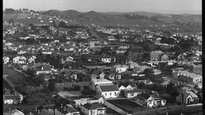
Te Tātua-a-Riukiuta (Three Kings) is one of the largest and most complex of the 50 volcanoes that make up Auckland’s Volcanic Field. It erupted about 28,500 years ago, forming three prominent volcanic cones, Highest King, East King and Big King, with a fourth smaller cone and a group of smaller scoria mounds.
Where volcanic ash and debris from the explosion settled on the surrounding terrain, a roughly circular formation of solid rock known as the tuff ring, was created. Where molten basalt lava flows crusted over, and the lava flows within them drained out, lava caves were also formed.
Prior to quarrying, all Three Kings were terraced pā. Some of the lava caves within the hills were important Māori burial places before the arrival of Europeans. Though few remain, these lava caves have considerable heritage significance.
Te Tātua-a-Riukiuta, and the surrounding area, has many layers of Māori history. Each iwi has a different story to tell of their connection to this land.
The original name for the volcano was Te Tātua a Matāho - the ‘war belt of Matāho’. It was later adapted to Te Tātua-a-Riukiuta, meaning ‘the belt of Ruikiuta. Te Tātua could have described the formation of the hills around the central citadel, or the tuff ring surrounding the complex.
Riukiuta was a tohunga (senior priest) of the Tainui people who settled in the area. Ngāti Riukiuta was the local hapū, the descendants of Riukiuta.
The pā was the home of the hapū known as Ngai Riukiuta. These people were of Tainui through Riukiuta; of Arawa through Ihenga-Ringaringaware and his brother Huarere, and of Ngāti Awa through Titahi. The pepeha (motto) of the hapū was Te Tātua-a-Riukiuta - the girdle of Riukiuta because they were bound together by a belt of ancestral unions.
Volcanic rock was used by Māori to line the terraces on the pā defences.. It is for this reason that Te Tātua is sometimes called Ngā Pare Toka a Rauiti, the rock headband of Rauiti, who lived in a pā at Te Tātua-a-Riukiuta with stone walls.
Quarried away
Wholesale quarrying of the Three Kings began in earnest in the 1870s, and by the late 1900s, the peaks were reduced to just one, the Big King, which remains today.
Big King occupied land owned by the Wesley Mission Trust from 1845 and in 1927, despite offers to sell, the trust chose to preserve the mountain for the people of Mt Roskill to enjoy. During the Second World War the land was sold to the government for housing, but in 1949 the land on which Big King was situated was gazetted as a reserve.
You can still walk around the Big King today, and you might even spot remnants of stone walling, which are thought to be of Māori origin.
Arthur S Richards Memorial Park
43-57 Parau Street
The Department of Housing Construction purchased this block of land from the Wesley College Trustees following the removal of the Wesleyan College building to Paerata (South Auckland) in the early 1920s.
When the first major state housing development scheme was planned for the area during the late 1930s and the 1940s, the land was earmarked by the Crown as a recreational reserve, and a decision was made to preserve the magnificent collection of large, mature trees on the site.
Control of the park area was formally vested in the council in 1951. At this time it was known as Parau Street Reserve, but in 1956 it was given the name Arthur Richards Memorial Park in honour of the former Roskill MP who played an important role in the land's conservation as a park. In 1984, at his daughter's request, an 'S' was inserted into the name to distinguish him from other family members with the same Christian names.
Wesley Training College
54 McCullough Avenue
A monument cairn was unveiled here on the approximate site of the original Wesley Training College buildings on 20 September 1941, to mark the centenary of the Methodist Church in New Zealand.
Established on this site in 1848, the Wesleyan College provided education training to mostly Māori students. From 1850 the institution was partly funded by the government to serve as an industrial school for European children as well. It was one of Auckland’s earliest religious institutions. By 1869 a dwindling school roll of only 19 Pākehā and five Māori students essentially spelled the end for the school. However, following a Wesleyan Methodist Conference in January 1876, the school was reinstated as a religious institution for Māori ministers and catechists, and continued to operate at Three Kings until 1922.
Around 1929 the main college building was removed and between then and 1939, some of the land formerly occupied by the training institution was subdivided and sold to private owners. A decision was made by the Road Board at the time to preserve the Big King volcanic cone as a public reserve.
In 1939, the government purchased 178 acres of the former Wesley Estate for the development of the first planned state housing area in Mt Roskill.
The monument you see before you was erected by the Department of Housing Construction and is thought to incorporate stone salvaged from the former buildings. The plaque on the memorial reads: ‘This marks the site of the Three Kings Wesleyan Native Institution Foundation stone laid by the Governor Sir George Grey, April 6 1848. Transferred to Wesley College Paerata August 28 1922.’
Rev W. A. Burley, the president of the NZ Methodist Conference, unveiled the memorial.
State Housing and Quarrying
Three Kings Reserve
In 1939, the first Labour Government purchased a substantial block of land from the Wesley Mission Trust for the development of the first large, comprehensively planned state housing area in Mt Roskill. It formed part of a governmental scheme to address the serious shortage of adequate housing and high rate of unemployment following the Depression. The Department of Housing Construction was set up to plan and manage the developments.
The first area of state housing to take shape was the Upper Wesley Estate on the volcanic slopes of Te Tātua-a-Riukiuta (Big King), on the former school grounds of the Wesley College. The 158-acre site encompassed Donald Crescent and Fearon Avenue, as well as the area east of Parau Street. Up to 500 new homes were planned for the site.
Construction of the state homes and surrounding amenities took place between 1939 and 1941. To service the burgeoning population, a block of shops was established on the corner of Fearon Avenue and Parau Street.
Though small and far from luxurious, the framing, floors and joinery of the houses were mostly built with quality native timber, and the amenities were modern for the time. No more than four detached houses were allocated per acreage of land and the Department of Housing Construction prepared over 400 unique plans to ensure the state houses were sufficiently varied in design. In common they shared: morning sun in the kitchen, afternoon sun in the main bedroom and small windows in the southern rooms.
Mature specimen trees, retained from the former Wesley Estate, brought beauty and colour to the development. New areas for recreation were also created, including Fearon Park and Arthur S. Richards Memorial Park.
Quarrying at Three Kings
From here you can see into the quarry and take in the changes to the landscape from over a century of intensive quarrying.
Locally quarried volcanic scoria was a popular material for retaining walls and roading in the area, and commercial quarrying was a key industry from the 1870s. William John Conelly was among the first to establish a quarry in the area in the mid-1870s. The Winstone brothers, George and William, bought the Conelly quarry in 1924. Their company, later renamed Winstone Aggregates, was purchased by Fletcher Building in 2000 and still exists today.
As much as 80 per cent of the original site, including two of Three Kings, were quarried away at a rapid rate. Trucks would bring scoria to the grading machine, and once a day the machine would roar to life, grading the scoria into piles. Later in the day, the crushing machines would get to work breaking down the larger boulders. Basalt or bluestone, was also valued and quarried for use in building and as street kerb stones.
Such was the pace of quarrying in the area, that in one account from the late 1920s, Tom Grinter, who owned a service station on Mt Albert Road, looked up from his work and was surprised to see Mt Eden through a gaping hole where the Southern King had not long before stood.
State housing resident, Elizabeth Fox, wrote: “Within a few years of living close by we were left with one King. By now from our kitchen window and back verandah we could see as far as the Good Shepherd Laundry at the very end of Dominion Road...and we certainly noticed the wind from the South West more than ever”.